
Abhishek|Deepak48 minutes ago
It has been one year since the devastating disaster that struck Dharali, Harsil and the Bhagirathi Valley in Uttarkashi on August 5, 2025.
The calamity reduced homes, markets, hotels, farmland, apple orchards and livelihoods to rubble within minutes. While scars of the tragedy remain, the affected region is gradually rebuilding and returning to normal.
Government says over ₹33 crore spent on relief and rehabilitation
According to the Uttarakhand government, more than ₹33 crore has been spent over the past year on relief, rehabilitation and development in the affected areas.
Various government departments have executed reconstruction and infrastructure projects worth over ₹16 crore, while financial assistance exceeding ₹17 crore has been distributed to affected families.
ISRO identified glacier ice collapse as cause of disaster
The disaster was initially believed to have been triggered by a cloudburst. However, a subsequent assessment by the Indian Space Research Organisation (ISRO) concluded that the catastrophe was caused by the sudden collapse of a massive ice patch beneath the Srikanta Glacier, leading to the destructive flow that ravaged the valley.
See in PHOTOS how the entire village was devastated in just moments…
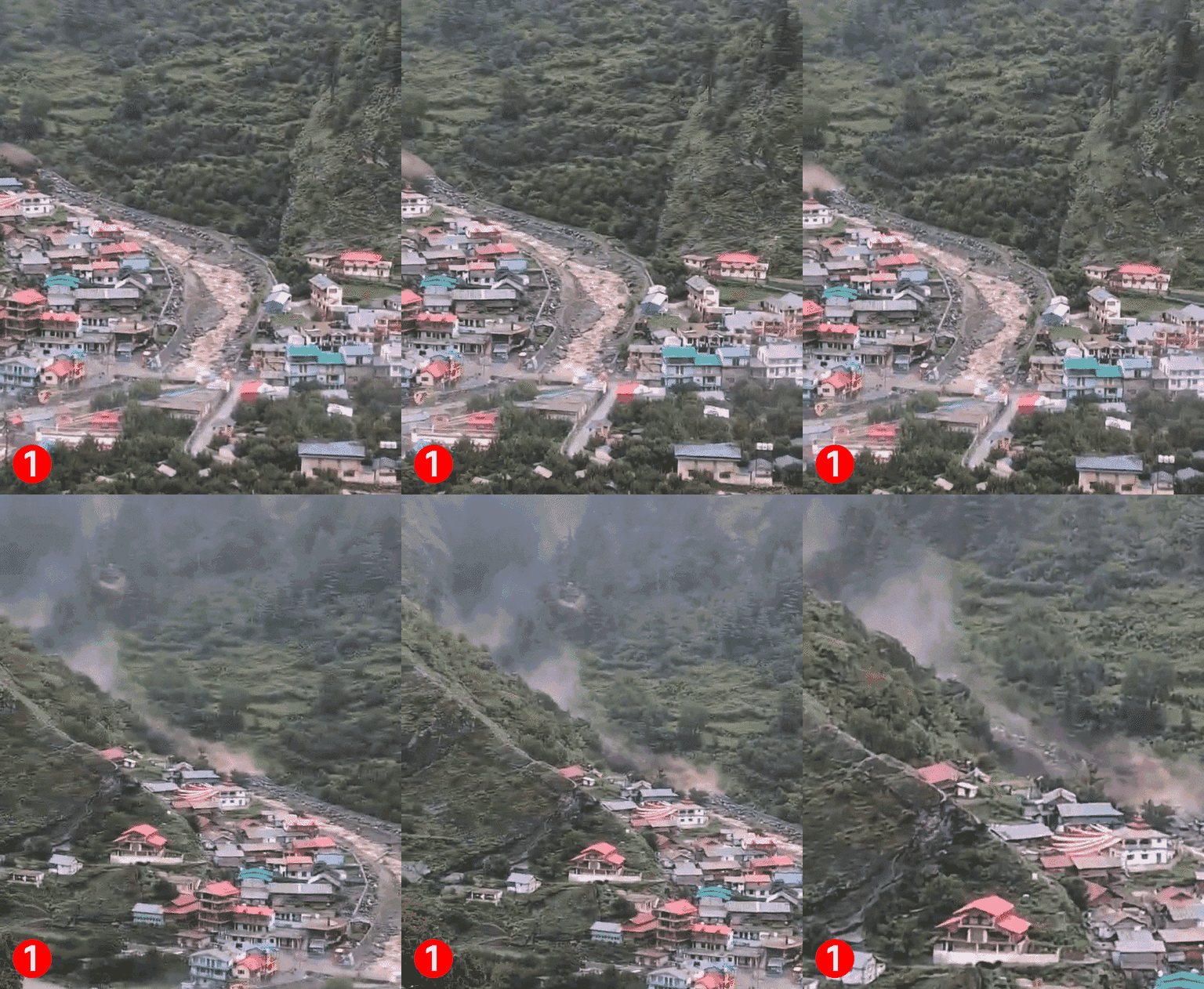
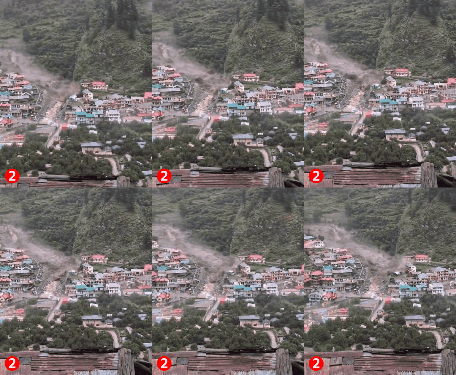
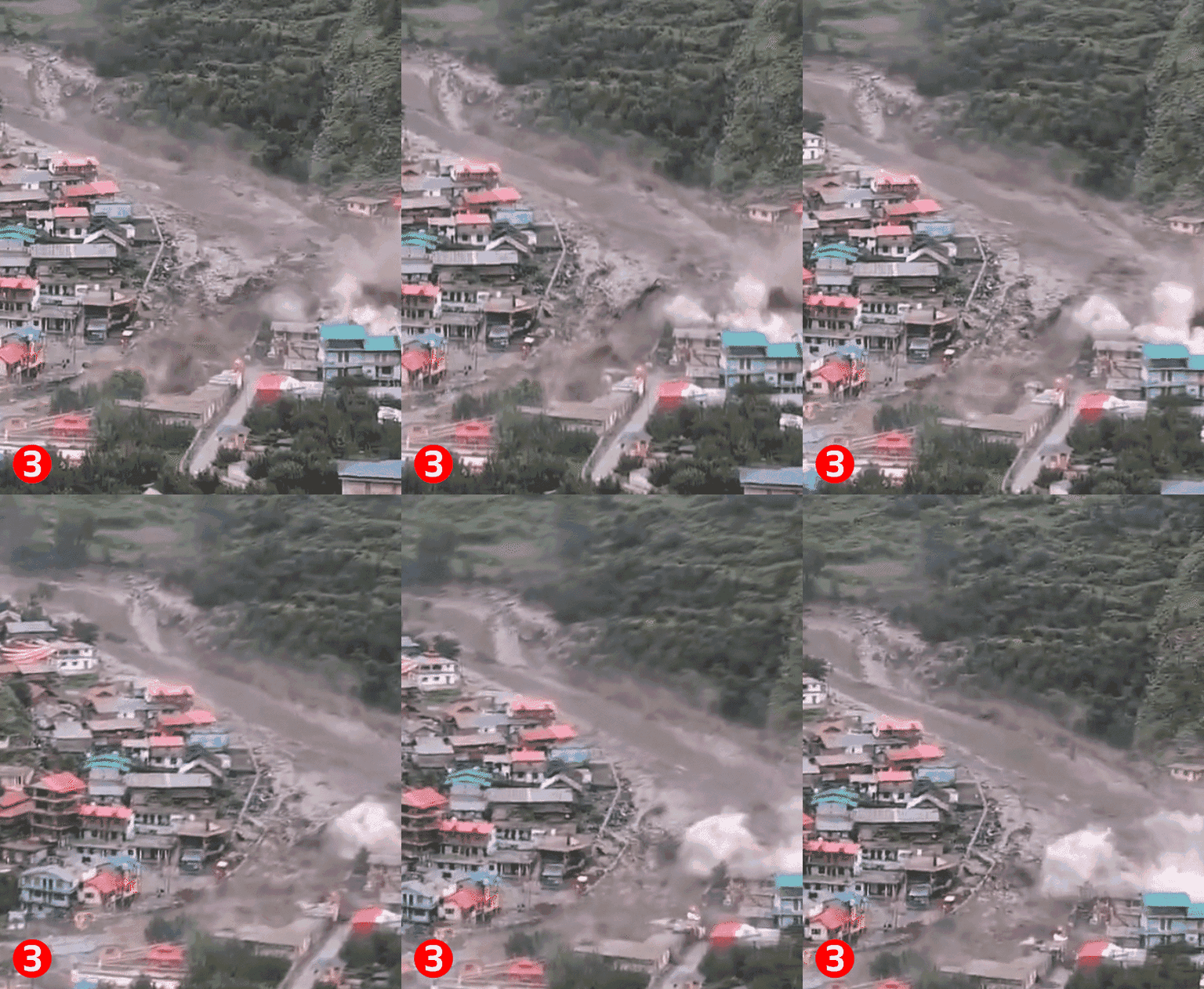
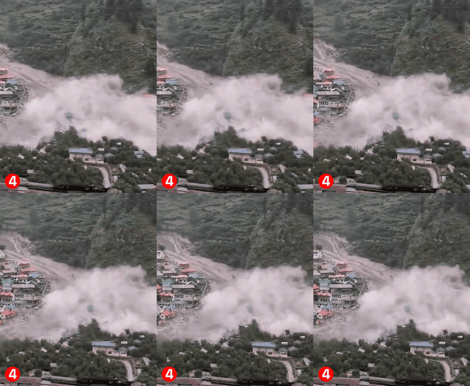
Now know what happened on August 5…
On the morning of August 5, 2025, debris and strong currents from the Kheer Ganga valley in Uttarkashi caused massive devastation in Dharali, Harsil, and surrounding areas. Within just a few minutes, Dharali’s market, hotels, homestays, houses, apple orchards, and roads were buried under debris.
19 people died and 18 were injured in the disaster, while 115 people became homeless. The relief and rescue operation continued for several days, in which the Army, ITBP, NDRF, SDRF, and district administration rescued more than 1400 people.
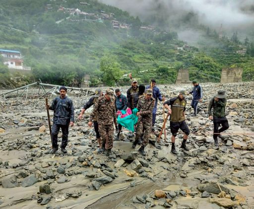
Team taking the injured to a nearby hospital after the disaster.
Know in 4 points what has changed after one year…
- Rebuilding livelihoods beyond infrastructure: Rehabilitation efforts have gone beyond rebuilding roads and buildings, with the government focusing on restoring livelihoods. Farmers received crop seeds and saplings, compensation was provided for damaged orchards, sheep and goat rearing was encouraged, and irrigation, drinking water and electricity networks were restored. Tourism activities have also been revived to strengthen the Bhagirathi Valley’s economy.
- Flood protection measures strengthened: Along with repairing damaged roads, authorities have carried out flood protection work along riverbanks. The objective is not only to restore the affected region but also to make it more resilient against future natural disasters.
- Infrastructure restored on a war footing: Over the past year, debris has been cleared from villages, damaged roads and culverts have been rebuilt, and essential services such as water supply and electricity have been restored. The Irrigation and Disaster Management Department has also constructed strong retaining walls and embankments along vulnerable drains to reduce the risk of future erosion.
- Apple orchards and tourism regain momentum: Known for its apple orchards and as a key halt for pilgrims travelling to Gangotri Dham, Dharali suffered heavy losses when farmland and orchards were washed away. Villagers have now begun rebuilding their livelihoods by nurturing surviving orchards, planting new apple saplings and welcoming the gradual return of tourists.
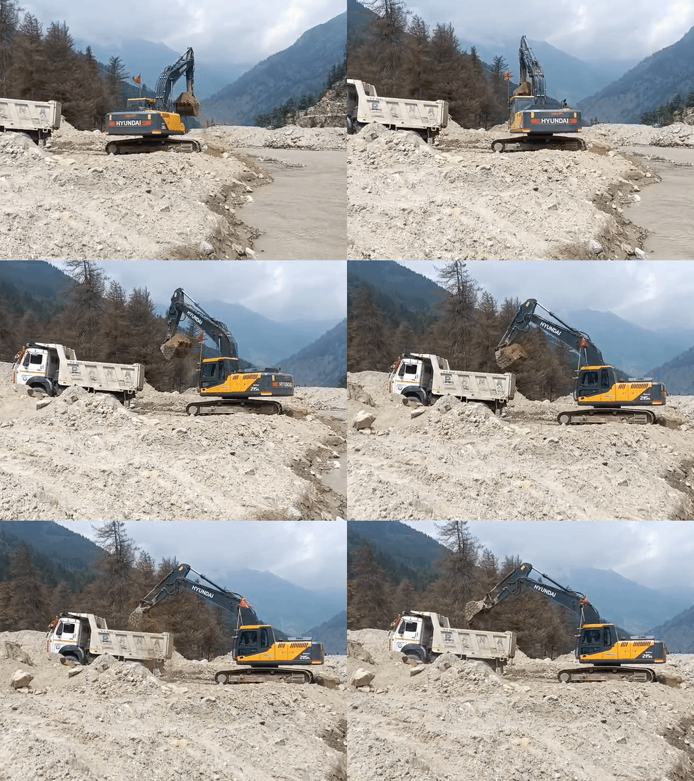
These days, due to rain again, Bhagirathi is in spate and the work of continuously removing debris is ongoing here.
ISRO study reveals the real cause of the Dharali disaster
Months after the devastating Dharali tragedy, scientists from the Indian Space Research Organisation (ISRO) uncovered the actual cause of the disaster through an extensive scientific investigation.
Using satellite imagery, digital terrain models and videos captured during the incident, the team concluded that the catastrophe was neither triggered by a cloudburst nor by a glacial lake outburst.
Collapse of glacier ice patch triggered flash flood
According to the ISRO study, a massive patch of permanent ice that had accumulated beneath the Shrikanta Glacier over several years became unstable due to rising temperatures and accelerated melting.
The ice mass suddenly collapsed and rushed down the steep mountain slope, picking up rocks, soil and debris along its path. The resulting high-speed debris flow reached Dharali within minutes, triggering the destructive flash flood that devastated the region.
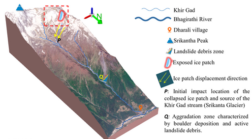
Image of a figure published in the research.
Satellite images provide strongest evidence
Satellite images captured between April and August 2025 played a crucial role in uncovering the cause of the Dharali disaster. Scientists observed that the entire region was covered in snow in April, while rapid melting became evident in images from June and July.
A large ice patch first appeared in the July 6 image, but had completely disappeared by August 12, with fresh erosion clearly visible at the site. Researchers described this sequence as the strongest evidence linking the disaster to the collapse of the ice patch.
2,500-metre descent intensified the destruction
The study found that the ice patch was located at an altitude of around 5,220 metres, while Dharali village lies at approximately 2,680 metres. The debris therefore plunged nearly 2,500 metres downhill.
As it rushed through steep slopes of 30 to 40 degrees and the narrow Kheer Gad valley, its speed increased dramatically, resulting in the powerful debris flow that devastated the village.
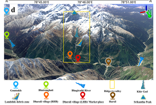
CM Dhami vows stronger and safer reconstruction
Uttarakhand Chief Minister Pushkar Singh Dhami said the Dharali disaster was not merely a challenge of rebuilding damaged infrastructure, but a responsibility to restore the lives and livelihoods of affected families.
He emphasised that the government’s focus extends beyond rehabilitation to creating a stronger future for the region.
Government aims to build a more resilient Bhagirathi Valley
The Chief Minister said the objective is to rebuild the Bhagirathi Valley as a safer, stronger and more prosperous region than before.
Along with relief, rehabilitation and reconstruction, the government is continuously implementing measures to minimise the impact of similar natural disasters in the future.